mapsExploring Florida
 FL Maps > State > Before 1700 > Route of De Soto and De Moscoso, 1539 to 1543
Site Map 

Route of De Soto and De Moscoso, 1539 to 1543


Puzzle Directions: Click on a puzzle piece and drag it where you want it. When you connect two pieces correctly, they will join together. Mix up the pieces again. View finished map in pop-up window.

Title: Route of De Soto and De Moscoso
Projection: Unknown
Source Bounding Coordinates:
W: E: N: S:

Back to Map Page
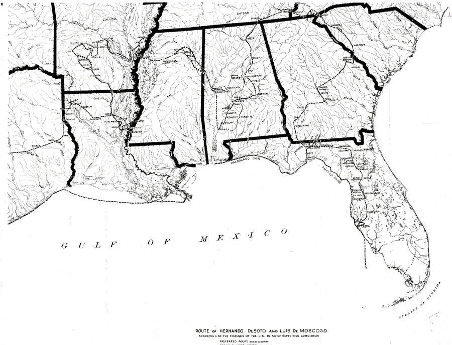
Description: A map showing the route of Hernando De Soto and Luis De Moscoso according to the findings of the U.S. De Soto Expedition Commission, 1939. Map shows Spanish place names along the route, and shows the route preferred by the commission along with possible alternative routes.
Source: John R. Swanton, Final Report of the US De Soto Expedition Commission (Washington, DC: Government Printing Office, 1939) Map 10
Map Credit: Courtesy the University of South Florida Library
SearchLicensePDF HelpGIS Help Google Earth Help Zoomify Help

 FL Maps > State > Before 1700 > Route of De Soto and De Moscoso, 1539 to 1543