mapsExploring Florida
 FL Maps > State > 1900-1919 > Seaboard Air Line Railroad and Connections, 1917
Site Map 

Seaboard Air Line Railroad and Connections, 1917


Puzzle Directions: Click on a puzzle piece and drag it where you want it. When you connect two pieces correctly, they will join together. Mix up the pieces again. View finished map in pop-up window.

Title: Seaboard Air Line Railroad and Connections
Projection: Unknown
Source Bounding Coordinates:
W: E: N: S:

Back to Map Page
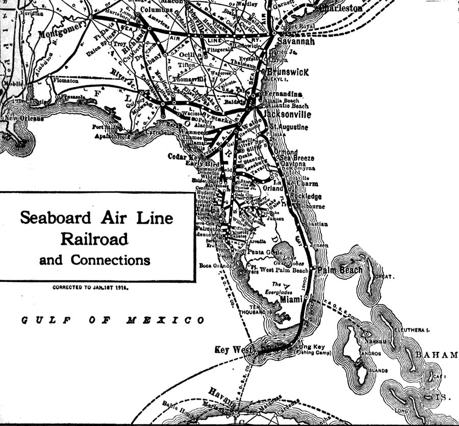
Description: Route map of the Seaboard Air Line Railroad current to 1916 running from New York to Key West. This portion of the map shows shipping routes into Savannah Georgia, between Miami and Nassau, Tampa and Key west, and Key West and Havana.
Source: Francis J. Reynolds, The New Encyclopedic Atlas and Gazetteer of the World (New York, NY: P. F. Collier and Son, 1917) 264
Map Credit: Courtesy the private collection of Roy Winkelman
SearchLicensePDF HelpGIS Help Google Earth Help Zoomify Help

 FL Maps > State > 1900-1919 > Seaboard Air Line Railroad and Connections, 1917