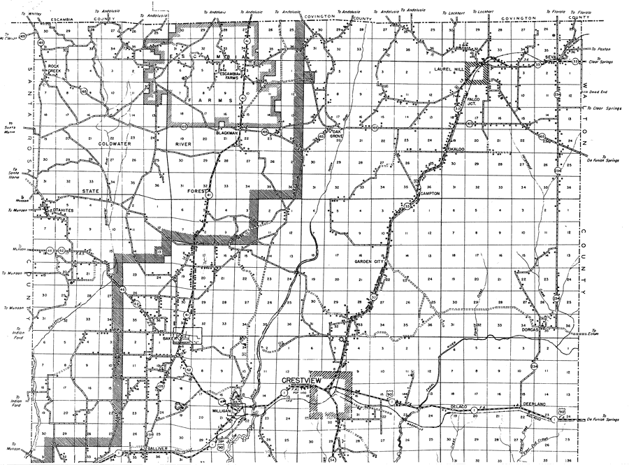
Description: This is a detailed map of the north portion of the county of Okaloosa in the state of Florida. Section Township Range (STR) is shown. This map shows all of the main cities, state roads, US highways, county seat, railroads, bridge highways, schools, churches, cemeteries, forest ranger lookout stations, businesses, turpentine stills, tenant houses, emergency field, sawmills, camps, a factory, farm units and dwellings other than farms. Key to Florida Highway maps.
Place Names: Okaloosa, Rock Creek, Blackwater River, Blackman, Escambia Farms, Oak Grove, Falco, Laurel Hill, Okaloo, Campton, Seva, Garden City, Dorcas, Dorcus, Baker, Otahites, Yellow River, Galliver, Milligan, Crestview, Delaco, Deerland
ISO Topic Categories: boundaries, transportation, location, inlandWaters
Keywords: North Okaloosa, physical, political, transportation, physical features, major political subdivisions, local jurisdictions, roads, railroads, boundaries, transportation, location, inlandWaters, Lambert_Conformal_Conic, 1936
Source: , Florida State Road Department (, FL: , 1936)
Map Credit: Courtesy the private collection of Roy Winkelman. |
|