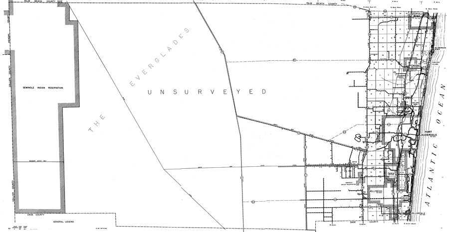
Description: This is a detailed map of the county of Broward in the state of Florida. Section Township Range (STR) is shown. This map shows all of the main cities, state roads, US highways, bridge highways, drawbridge highways, canals, railroads, inland waters, county boundary, camps, schools, post offices, hotels, cattle guards, churches, cemeteries, farm units, dwellings other than farms, tenant houses, businesses, airports, and factories. Key to Florida Highway maps.
Place Names: Broward, Everglades, Deerfield Beach, Pompano , Seminole Indian Reservation, Hillsborough Beach, Pinehurst Village, Oakland Park, Ft. Lauderdale, Fort Lauderdale, Atlantic Ocean, New River, Davie, Dania , Hollywood, Hallandale
ISO Topic Categories: boundaries, inlandWaters, location, transportation, oceans
Keywords: Broward, physical, political, transportation, physical features, major political subdivisions, county borders, local jurisdictions, roads, railroads, boundaries, inlandWaters, location, transportation, oceans, Unknown,1940
Source: , Florida State Road Department (, FL: , 1940)
Map Credit: Courtesy the private collection of Roy Winkelman. |
|