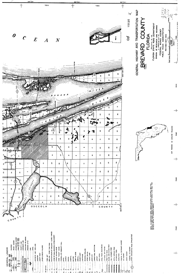
Description: This is a detailed map of the north part of the county of Brevard in the state of Florida. Section Township Range (STR) is shown. This map shows all of the main cities, state roads, US Highways, bridge highways, drawbridge highways, federal aided highways, railroads, inland waters, canals, airports, corporate lines, county boundaries, camps or lodges, post offices, cemeteries, churches, farm units, dwellings other than farms, tenant houses, businesses and schools. Key to Florida Highway maps.
Place Names: Brevard, Merritt Island, Rockledge, Lake Poinsett, Bonaventure, New Found Harbor, Georgiana, Indian River, Cocoa, Cocoa Beach, Banana River, Footman, Pineda, Tropic, Atlantic Ocean
ISO Topic Categories: boundaries, inlandWaters, oceans, location, transportation
Keywords: North Brevard 4, physical, political, transportation, physical features, major political subdivisions, local jurisdictions, county borders, roads, railroads, boundaries, inlandWaters, oceans, location, transportation, Unknown,1936
Source: , Florida State Road Department (, FL: , 1936)
Map Credit: Courtesy the private collection of Roy Winkelman. |
|