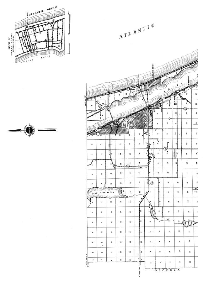
Description: This is a detailed map of the south part of the county of Brevard in the state of Florida. Section Township Range (STR) is shown. This map shows all of the main cities, state roads, US Highways, bridge highway, federal aided highways, railroads, inland waters, corporate lines, county boundaries, camps or lodges, farm units, dwellings other than farms and businesses. Key to Florida Highway maps.
Place Names: Brevard, Eau Gallie, Indialantic, Melbourne, Malabar, Hopkins, Palm Bay, Melbourne Beach, Cape Malabar, Malabar, Lake Washington, Atlantic Ocean
ISO Topic Categories: boundaries, inlandWaters, oceans, location, transportation
Keywords: South Brevard 2, physical, political, transportation, physical features, major political subdivisions, local jurisdictions, county borders, roads, railroads, boundaries, inlandWaters, oceans, location, transportation, Unknown,1936
Source: , Florida State Road Department (, FL: , 1936)
Map Credit: Courtesy the private collection of Roy Winkelman. |
|