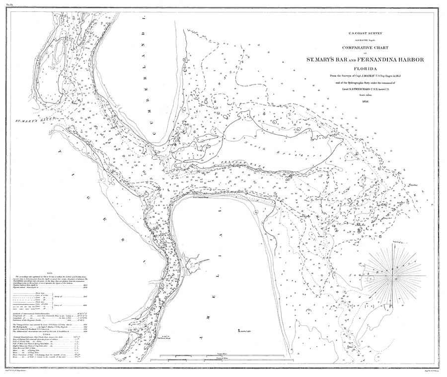
Description: A pre-Civil War map of the waterway at the mouth of the St. Mary's river comparing soundings from the survey of 1843 and the survey of 1856. Soundings are shown in feet for the 6, 12, and 18-foot depths. Water depths have a strategic significance for the accessibility to Fort Clinch. The Amelia Island lighthouse and several marker buoys are shown. The map scale is 1:20,000. N.O.A.A. map reference: 24-00-1856. Key to NOAA maps. PLEASE NOTE: This historical data is not to be used for navigation or navigation planning. The Florida Center for Instructional Technology (FCIT) does not assume responsibility for the improper use of these data.
Place Names: Nassau, Fort Clinch, Old Fernandina, Cumberland Island, Amelia Island, Tiger Island
ISO Topic Categories: boundaries, inlandWaters, oceans, transportation
Keywords: Comparative Chart of St. Mary's Bar and Fernandina Harbor, Florida, physical, transportation, hydrological, physical features, topographical, water routes, water depths, boundaries, inlandWaters, oceans, transportation, Unknown,1856
Source: J. Mackay, (Washington, DC: U.S. Coast Survey, 1856)
Map Credit: Courtesy the U.S. National Oceanic and Atmospheric Administration |
|