Title: Comparative Chart of St. Mary's Bar and Fernandina Harbor, Florida
Projection: Unknown
Source Bounding Coordinates:
W: E: N: S: |
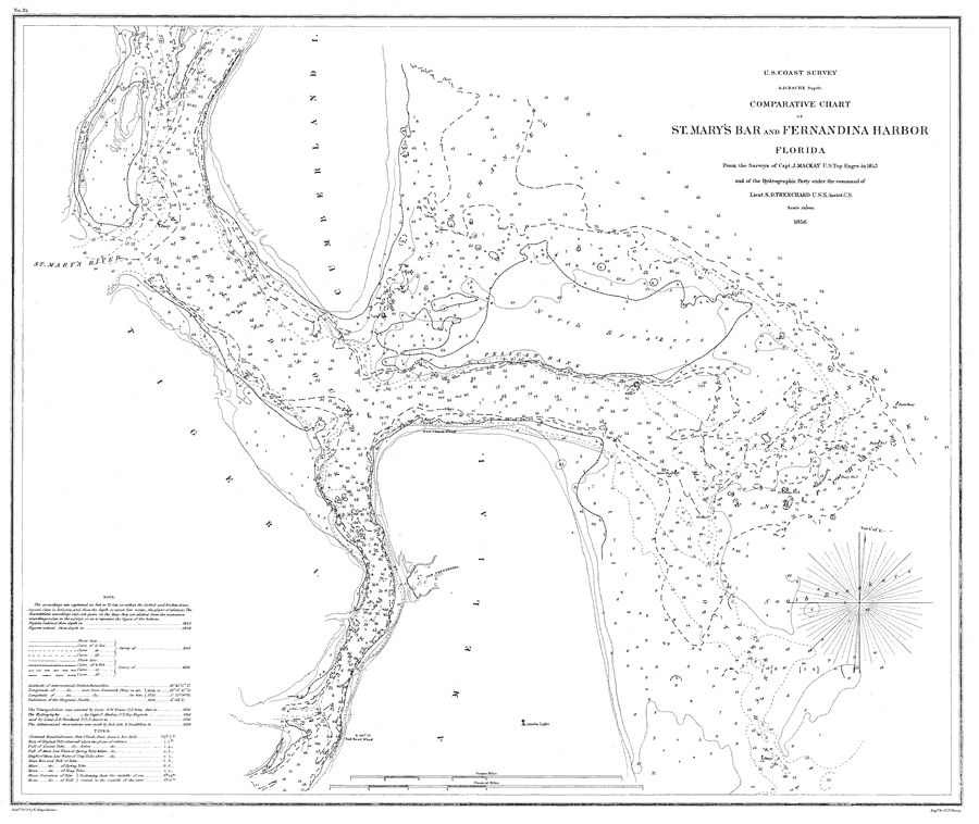
| | Description: A pre-Civil War map of the waterway at the mouth of the St. Mary's river comparing soundings from the survey of 1843 and the survey of 1856. Soundings are shown in feet for the 6, 12, and 18-foot depths. Water depths have a strategic significance for the accessibility to Fort Clinch. The Amelia Island lighthouse and several marker buoys are shown. The map scale is 1:20,000. Key to NOAA maps.
Source: J. Mackay, (Washington, DC: U.S. Coast Survey, 1856)
Map Credit: Courtesy the U.S. National Oceanic and Atmospheric Administration |
| |
| FL Maps > Local > Nassau > Comparative Chart of St. Mary's Bar and Fernandina Harbor, Florida, 1856 | |
|