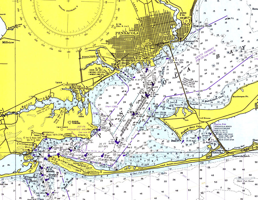
Title: Pensacola and Pensacola Bay
Projection: Mercator,
Source Bounding Coordinates:
W: -87.2 E: -87.08 N: 30.3 S: 30.18 |
| | Description: A National Oceanic and Atmospheric Administration map of Pensacola and Pensacola Bay current to 1975. This National Ocean Survey chart shows all soundings expressed in feet. Navigational aids such as safety fairways, visual markers such as radio and water towers, and measures of magnetic declination variances are shown as well as obstructions such as fixed bridges, missile testing and explosives dumping areas. The map scale is 1:80,000. Chart is LORAN-A overprinted. N.O.A.A. map reference: 11382LORANA-10-1975. Key to NOAA maps. PLEASE NOTE: This historical data is not to be used for navigation or navigation planning. The Florida Center for Instructional Technology (FCIT) does not assume responsibility for the improper use of these data.
Source: National Oceanic and Atmospheric Administration, Gulf Coast (Washington, DC: United States Coast and Geodetic Survey, 1975)
Map Credit: Courtesy the U.S. National Oceanic and Atmospheric Administration |
| |
|