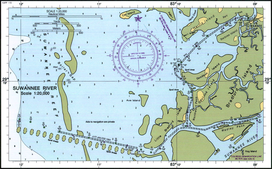
Description: A National Oceanic and Atmospheric Administration map of the entrance to the Suwannee River current to 1998. This Survey chart shows all soundings expressed in feet. Navigational aids such as lights, beacons, buoys, and magnetic variance and annual increase are shown, as well as obstructions such as submerged piles. The map scale is 1:20,000. N.O.A.A. map reference: 11408-10-1998. Key to NOAA maps. PLEASE NOTE: This historical data is not to be used for navigation or navigation planning. The Florida Center for Instructional Technology (FCIT) does not assume responsibility for the improper use of these data.
Source: National Oceanic and Atmospheric Administration, (Washington, DC: United States Coast and Geodetic Survey, 1998)
Map Credit: Courtesy the U.S. National Oceanic and Atmospheric Administration |
|