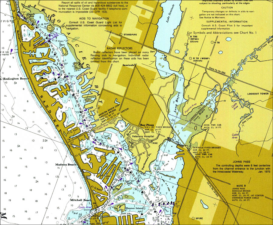
Title: Redington Beach to Madeira Beach
Projection: Mercator,
Source Bounding Coordinates:
W: E: N: S: |
| | Description: A National Oceanic and Atmospheric Administration map of the Intracoastal Waterway between Redington Beach and Madeira Beach. This National Ocean Survey chart shows all soundings expressed in feet. Navigational aids such as safety fairways, and visual markers such as lights, buoys and beacons are shown as well as obstructions such as fixed bridges and submerged piles. Key to NOAA maps.
Source: National Oceanic and Atmospheric Administration, National Ocean Survey (Washington, DC: National Oceanic and Atmospheric Administration, 1977)
Map Credit: Courtesy of the U.S. National Oceanic and Atmospheric Administration |
| |
|