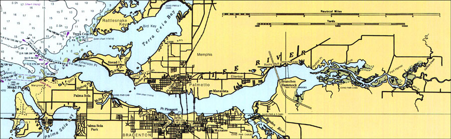
Description: A National Oceanic and Atmospheric Administration map of Bradenton, Palmetto, and the entrance to the Manatee River. This National Ocean Survey chart shows all soundings expressed in feet. Navigational aids such as safety fairways, and visual markers such as lights, buoys, and beacons are shown as well as obstructions such as fixed bridges and overhead power cables. Key to NOAA maps.
Source: National Oceanic and Atmospheric Administration, (Washington, DC: US Coast and Geodetic Survey, 1996)
Map Credit: Courtesy of the U.S. National Oceanic and Atmospheric Administration |
|