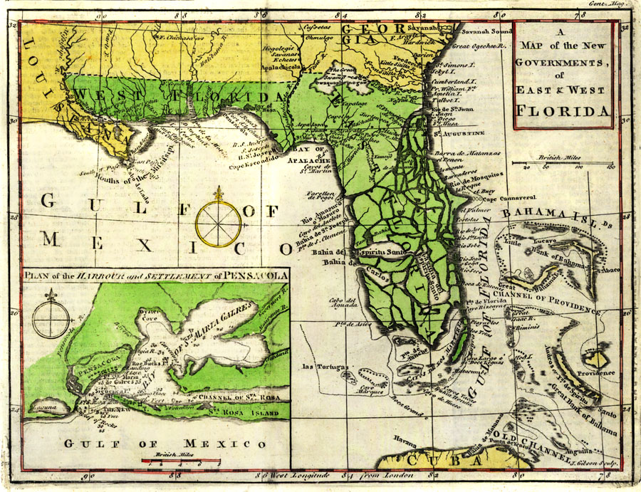
Description: Digitization provided by the USF Libraries Digitization Center. Rare Maps. An increasingly scarce map of Florida, just after its acquisition from Spain by Great Britain at the end of the French and Indian War, and its division into two Governments, East and West. Published in Gentlemen's Magazine, Gibson shows the Florida peninsula as essentially an archipelago. At the lower left corner is an inset "Plan of the Harbour and Settlement of Pensacola," then the capital of West Florida. Scale [ca. 1:420,000]. Prime meridian: London. Measurements.Dimensions: 18 x 24 cm., on sheet 22 x 35 cm.
Source: J. Gibson, Gentlemen's Magazine (London, : Gentlemen's Magazine, 1763)
Map Credit: Courtesy of the Special Collections Department, University of South Florida. |
|