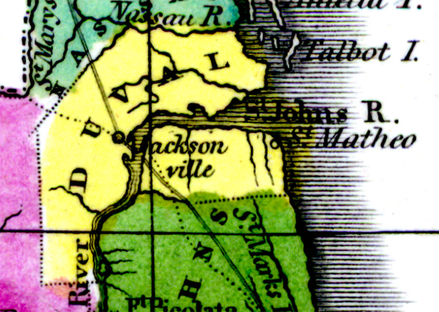
Description: Digitization provided by the USF Libraries Digitization Center. Rare Maps. This is a detail map of Duval county circa 1834. It shows important cities and towns of the time including Jacksonville and the Spanish settlement of St. Matheo (also known as St. Juan). It also shows inland waters including the St. Johns River.
Source: William Darby, Memoir on the geography and natural and civil history of Florida (Philadelphia, PA: Thomas H. Palmer, 1834)
Map Credit: Courtesy of the Special Collections Department, University of South Florida. |
|