Key to NOAA maps.
FL Maps
>
Local
>
Broward
> Port Everglades, 1999
Site Map
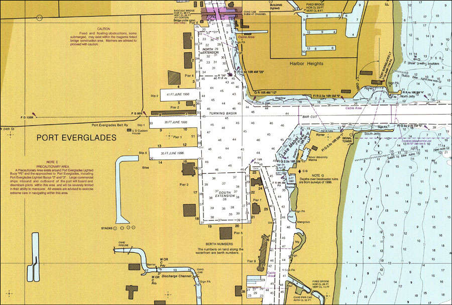
Port Everglades, 1999
Puzzle Directions:
Click on a puzzle piece and drag it where you want it. When you connect two pieces correctly, they will join together.
Mix up
the pieces again.
View finished map
in pop-up window.
Title: Port Everglades
Projection: Mercator,
Source Bounding Coordinates:
W: E: N: S:
Back to Map Page
Description: A National Oceanic and Atmospheric Administration map of Port Everglades current to 1999. This Department of Commerce chart shows all soundings expressed in feet at mean lower low water. Navigational aids such as lights and beacons are shown as well as obstructions such as shoals, submerged piles, fixed bridges and overhead cables. The map scale is 1:10,000. North American Datum of 1983 and World Geodetic System of 1984 are used.
Key to NOAA maps.Source: National Oceanic and Atmospheric Administration,
Fort Lauderdale, Port Everglades
(Washington, D.C.: U.S. Department of Commerce, 1999)
Map Credit: Courtesy the U.S. National Oceanic and Atmospheric Administration
Search
License
PDF Help
GIS Help
Google Earth Help
Zoomify Help
FL Maps
>
Local
>
Broward
> Port Everglades, 1999
Site Map