Title: Port of Palm Beach
Projection: Mercator,
Source Bounding Coordinates:
W: -80 E: -80 N: 26.5 S: 26.5 |
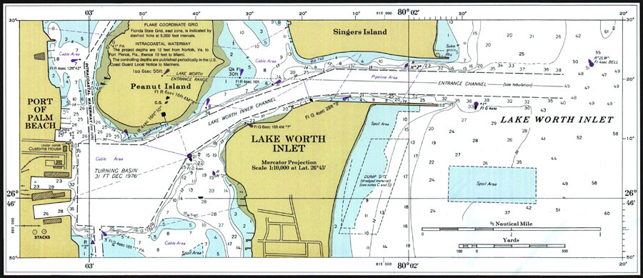
| | Description: A National Oceanic and Atmospheric Administration map of Port of Palm Beach, Florida current to 1999. This Department of Commerce chart shows all soundings expressed in feet at mean lower low water. Navigational aids such as lights, beacons and buoys are shown as well as obstructions such as shoals, submerged piles, wreckages, fixed bridges and overhead cables. The map scale is 1:80,000. North American Datum of 1927 is used. A detailed map of the Port of Palm Beach and Lake Worth Inlet is included. Key to NOAA maps.
Source: National Oceanic and Atmospheric Administration, Jupiter Inlet to Fowey Rocks (Washington, D.C.: U.S. Department of Commerce, 1977)
Map Credit: Courtesy the U.S. National Oceanic and Atmospheric Administration |
| |
|