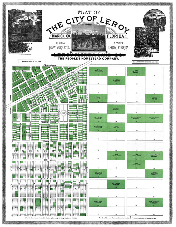
Description: Digitization provided by the USF Libraries Digitization Center. Rare Maps. This is a detailed map showing the plat of the city of Leroy, circa 1890. Section Township Range (STR) is shown. All lots in green are sold and ownership is shown. This map shows illustrations of Florida, roads, railroads and location. Scale: 300 ft. to the inch.
Place Names: Marion, Leroy
ISO Topic Categories: transportation, location, boundaries
Keywords: Plat of the City of Leroy, Marion Co., Florida, transportation, physical, political, historical, local jurisdictions, roads, railroads, transportation, location, boundaries, Unknown,1890 AD
Source: , (New York, NY: People's Homestead Company, 1890)
Map Credit: Courtesy of the Special Collections Department, University of South Florida. |
|