mapsExploring Florida
 FL Maps > State > 1760-1779 > Carta Rappresentante la Penisola della Florida, 1763 AD
Site Map 

Carta Rappresentante la Penisola della Florida, 1763 AD


Puzzle Directions: Click on a puzzle piece and drag it where you want it. When you connect two pieces correctly, they will join together. Mix up the pieces again. View finished map in pop-up window.

Title: Carta Rappresentante la Penisola della Florida
Projection: Unknown
Source Bounding Coordinates:
W: E: N: S:

Back to Map Page
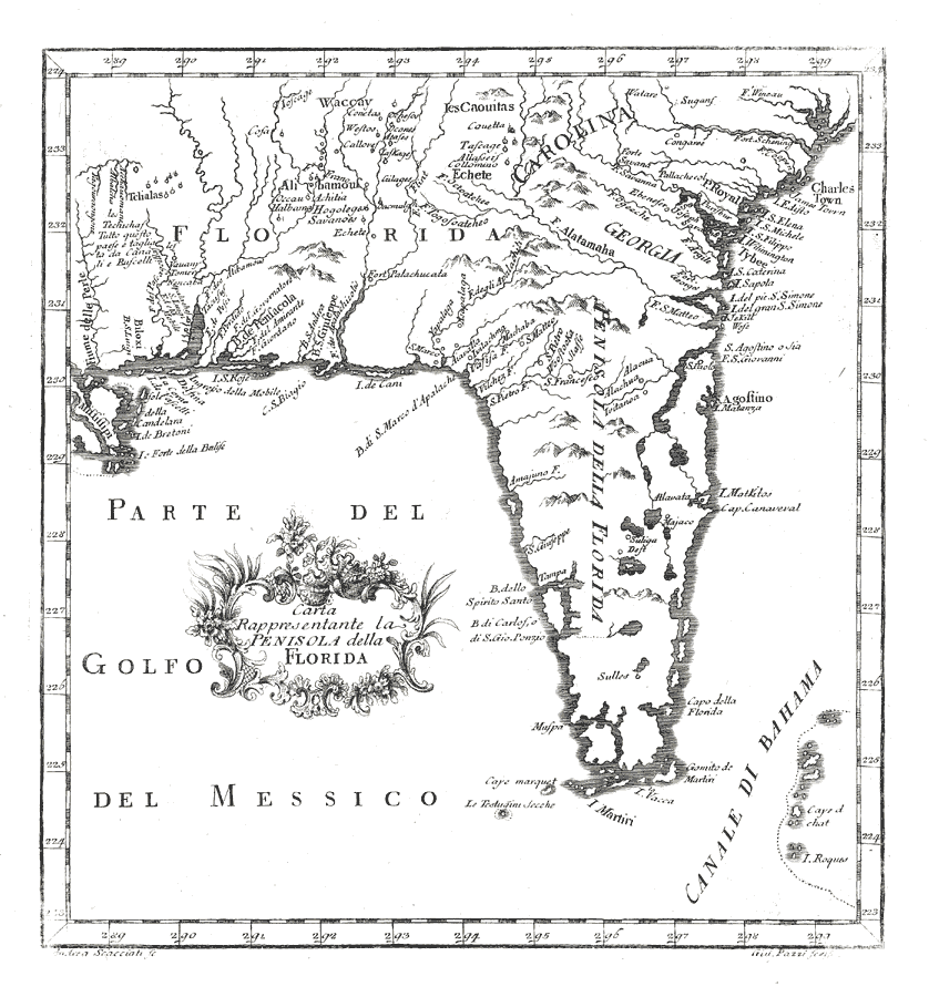
Description: Digitization provided by the USF Libraries Digitization Center. Rare Maps. This is a map of Florida from Italy, circa 1763. It also includes part of the southeast U. S. including South Carolina and Georgia. It shows cities, towns and inland waters. Measurements.Dimensions: 23 x 25 cm. Measurements.Resolution: Scale ca. 1:6,000,000
Source: Andrea Scacciati and Giuseppe Pazzi, Il Gazzettiere Americano, v. 1 (Livorno, Italy, : Marco Coltellini, 1763) 191
Map Credit: Courtesy of the Special Collections Department, University of South Florida.
SearchLicensePDF HelpGIS Help Google Earth Help Zoomify Help

 FL Maps > State > 1760-1779 > Carta Rappresentante la Penisola della Florida, 1763 AD