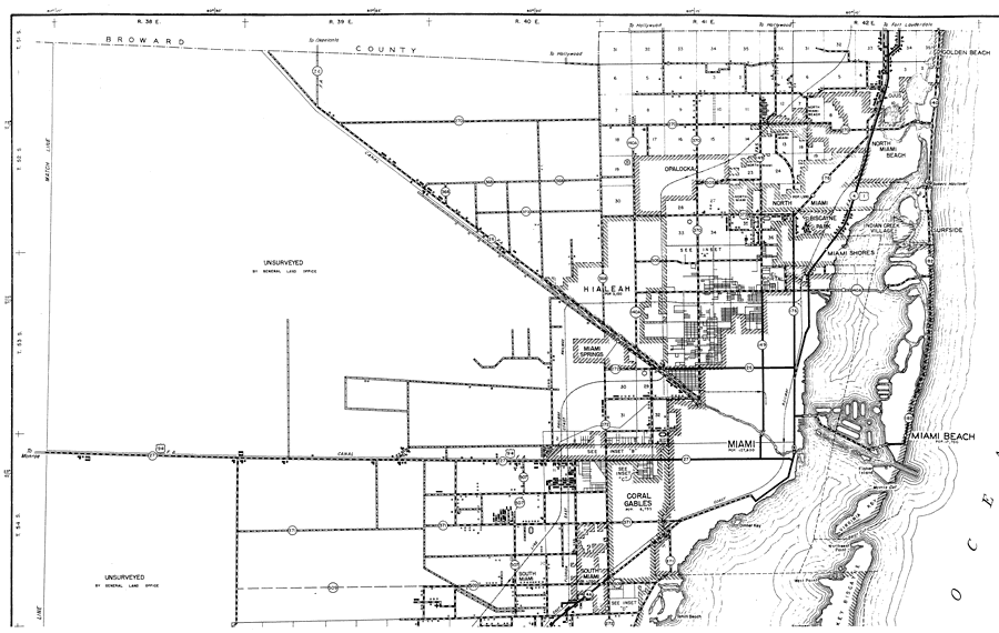
Description: This is a detailed map of the north part of the county of Dade in the state of Florida. Section Township Range (STR) is shown. This map shows all of the main cities, state roads, US Highways, bridge highways, federal aided highway, saw mills, citrus packinghouses, railroads, inland waters, corporate lines, county boundary, county seat, camp or lodge, post offices, churches, farm units, dwellings other than farms, tenant houses, businesses, hotels, race tracks, radio station, golf course, airports, schools, hospitals and factories. Key to Florida Highway maps.
Place Names: Dade, North Miami, North Miami Beach, Miami, Indian Creek Village, Biscayne Park, Surfside, Golden Beach, Ojus, Opalocka, Miami Shores, Hialeah, Miami Springs, Miami Beach, Coral Gables, South Miami, Atlantic Ocean, Key Biscayne, El Portal
ISO Topic Categories: boundaries, inlandWaters, oceans, location, transportation
Keywords: North Dade, physical, political, transportation, physical features, county borders, local jurisdictions, roads, railroads, boundaries, inlandWaters, oceans, location, transportation, Unknown,1936
Source: , Florida State Road Department (Tallahassee, FL: FDOT, 1936)
Map Credit: Courtesy the private collection of Roy Winkelman. |
|