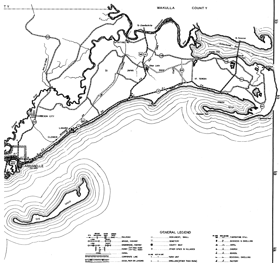
Description: This is a detailed map of the east portion of the county of Franklin in the state of Florida. Section Township Range (STR) is shown. This map shows all of the main cities, state roads, US Highways, bridge highways, federal aided highway, saw mills, railroads, inland waters, corporate lines, county boundary, schools, seasonal dwellings, hotels, cemeteries, and dwellings other than farms. Key to Florida Highway maps.
Place Names: Franklin, McIntyre, St. Teresa, Silver Lake, James, Harbeson City, Lanark, Clower, Carrabelle, Dog Island, Ocklockonee River
ISO Topic Categories: boundaries, inlandWaters, location, transportation
Keywords: East Franklin, physical, political, transportation, physical features, county borders, local jurisdictions, roads, railroads, boundaries, inlandWaters, location, transportation, Lambert_Conformal_Conic, 1936
Source: , Florida State Road Department (Tallahassee, FL: FDOT, 1936)
Map Credit: Courtesy the private collection of Roy Winkelman. |
|