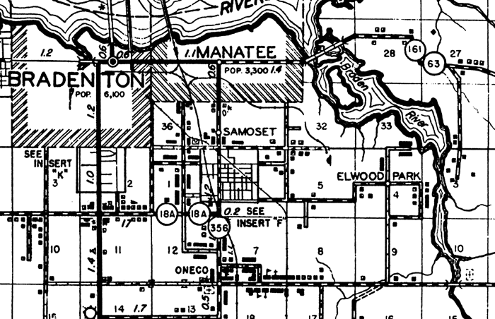
Description: This is a detailed map of the city Samoset in Manatee County, Florida. Section Township Range (STR) is shown. This map shows state roads, railroads, businesses, seasonal dwellings, airport, county seat, schools, church, post office, cemetery, sawmill, farm units and dwellings other than farms. Key to Florida Highway maps.
Place Names: Manatee, Bradenton, Manatee, Samoset, Elwood Park, Oneco
ISO Topic Categories: boundaries, transportation, location, inlandWaters
Keywords: Samoset, physical, political, transportation, physical features, local jurisdictions, roads, boundaries, transportation, location, inlandWaters, Unknown,1940
Source: , Florida State Road Department (Tallahassee, FL: FDOT, 1940)
Map Credit: Courtesy the private collection of Roy Winkelman. |
|