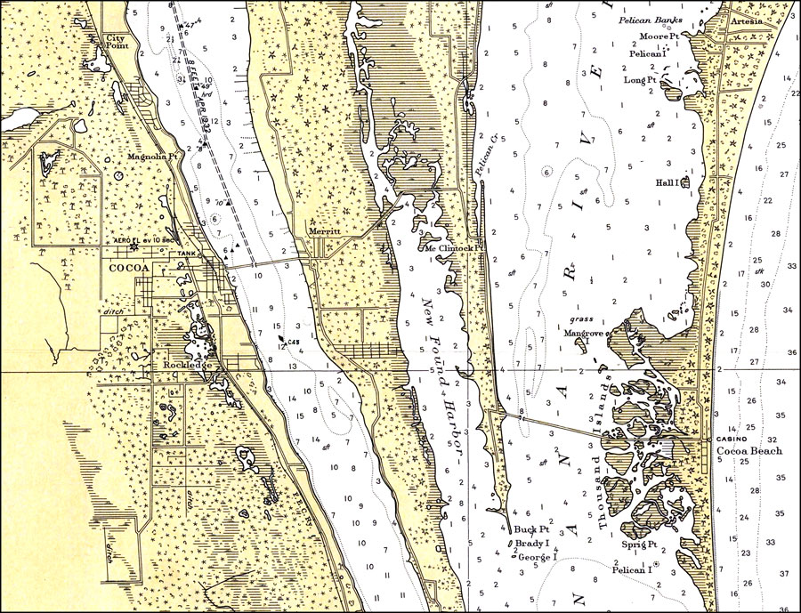
Description: A portion of the National Oceanic and Atmospheric Administration map of the area between Cape Canaveral and Bethel Shoal current to 1932 showing Cocoa to Cocoa Beach. This National Ocean Survey chart shows all soundings expressed in feet. Navigational aids such as lights, beacons, and buoys are shown as well as obstructions such as shoals, submerged piles, fixed bridges and submerged wreckage, The map scale is 1:80,000. N.O.A.A. map reference: 1246_8-1933. Key to NOAA maps. PLEASE NOTE: This historical data is not to be used for navigation or navigation planning. The Florida Center for Instructional Technology (FCIT) does not assume responsibility for the improper use of these data.
Source: National Oceanic and Atmospheric Administration, East Coast Survey (Washington, DC: National Oceanic and Atmospheric Administration, 1932)
Map Credit: Courtesy the U.S. National Oceanic and Atmospheric Administration |
|