Title: Parker and Callaway
Projection: Transverse_Mercator, Lambert_Conformal_Conic,
Source Bounding Coordinates:
W: E: N: S: |
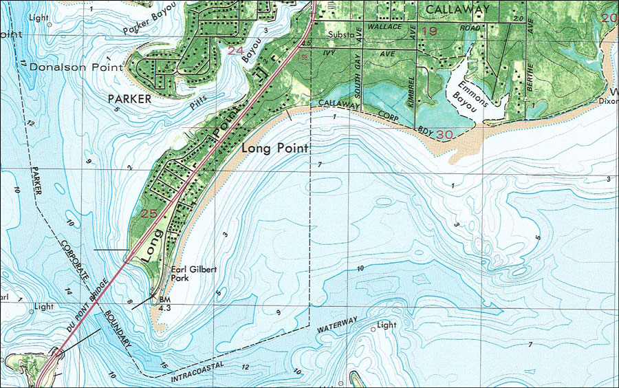
| | Description: A portion of the National Ocean Survey map of Overstreet current to 1982 showing the cities of Parker, Calloway, and Long Point. This orthophotomap shows both topographic and bathymetric features. Topographic and bathymetric contour intervals are shown in meters. Contour lines are shown at 2-meter intervals with supplemental contour intervals at 1 meter. Bathymetric datum is mean lower low water. The map shows man made structures such as major roads and streets, the Du Pont Bridge, the Intracoastal Waterway as well as various buildings including schools, residences, et cetera. Natural features include rivers, bayous, swamps, wetlands, and partially submerged land exposed at mean low tide. The map scale is 1:24,000. This information is not intended for navigational purposes. The National Geodetic Vertical Datum of 1929 is used in this map. The projection used 1927 North American Datum with reference on converting to North American Datum 1983. Key to NOAA maps. PLEASE NOTE: This historical data is not to be used for navigation or navigation planning. The Florida Center for Instructional Technology (FCIT) does not assume responsibility for the improper use of these data.
Source: USGS and NOAA, Long Point Quadrangle (Reston, VA: United States Geological Survey, 1982)
Map Credit: Courtesy the U.S. National Oceanic and Atmospheric Administration |
| |
|