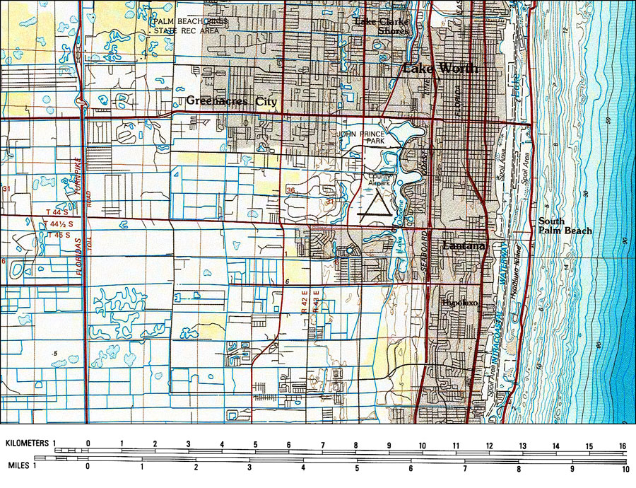
Title: Lake Worth and Vicinity
Projection: Transverse_Mercator,
Source Bounding Coordinates:
W: E: N: S: |
| | Description: A portion of the US Geological Survey and National Ocean Service 30X60 minute West Palm Beach Quadrangle current to 1985 showing Lake Worth. Also shown are Greenacres City, South Palm Beach, Lantana, Hypoluxo, and Lake Clarke Shores. This topographic-bathymetric map shows elevations and depths in meters. Contour interval 5 meters. Bathymetric contour interval 2 meters. Map also includes primary and secondary roads, railroads, airports, waterways, parks, and wetlands. Map divided into townships and ranges. North American 1929 Datum used. The map scale is 1:100,000, metric. N.O.A.A. map reference: 26080_E1_TB_100-00-1985. Key to NOAA maps. PLEASE NOTE: This historical data is not to be used for navigation or navigation planning. The Florida Center for Instructional Technology (FCIT) does not assume responsibility for the improper use of these data.
Source: US Geological Survey and National Ocean Service, West Palm Beach Quadrangle (Reston, VA: US Geological Survey, 1985)
Map Credit: Courtesy the U.S. National Oceanic and Atmospheric Administration |
| |
|