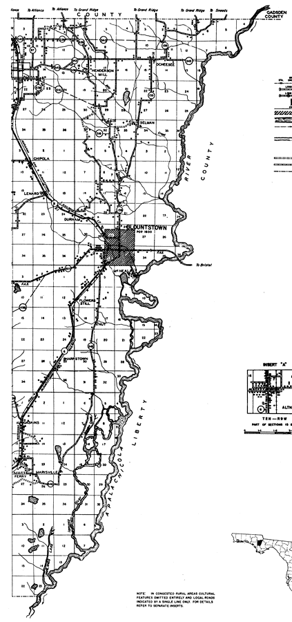
Description: This is a detailed map of the east portion of the county of Calhoun in the state of Florida. Section Township Range (STR) is shown. This map shows all of the main cities, state roads, bridge highways, railroads, inland waters, ferries, corporate lines, county boundaries, businesses, churches, sawmills, cemeteries, schools, tenant houses, federal aided highways and turpentine stills. Key to Florida Highway maps.
Place Names: Calhoun, Henderson Mill, Ocheesee, Selman, Altha, Apalachicola River, Chipola, Lenard, Durham, Blountstown, McNeal, Flowers Still, Nut, Sharpstown, Gaskins, Marysville, Scotts Ferry
ISO Topic Categories: boundaries, location, transportation, inlandWaters
Keywords: East Calhoun, physical, transportation, political, physical features, major political subdivisions, county borders, local jurisdictions, roads, railroads, boundaries, location, transportation, inlandWaters, Unknown,1936
Source: , Florida State Road Department (, FL: , 1936)
Map Credit: Courtesy the private collection of Roy Winkelman. |
|