mapsExploring Florida
 FL Maps > County > Dade > Dade County, 1890
Site Map 

Dade County, 1890


Puzzle Directions: Click on a puzzle piece and drag it where you want it. When you connect two pieces correctly, they will join together. Mix up the pieces again. View finished map in pop-up window.

Title: Dade County
Projection: Unknown
Source Bounding Coordinates:
W: E: N: S:

Back to Map Page
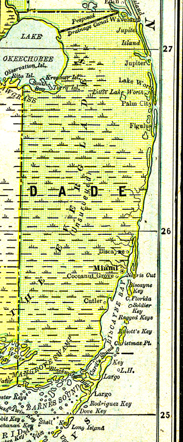
Description: A map of Dade County showing major cities, towns, bodies of water, county lines, and the county seat (Miami) current to 1890. The railroad did not reach Miami until April 7, 1896.
Source: George F. Cram, (Chicago, IL: Geo. F. Cram, 1890) 47
Map Credit: Courtesy the private collection of Roy Winkelman.
SearchLicensePDF HelpGIS Help Google Earth Help Zoomify Help

 FL Maps > County > Dade > Dade County, 1890