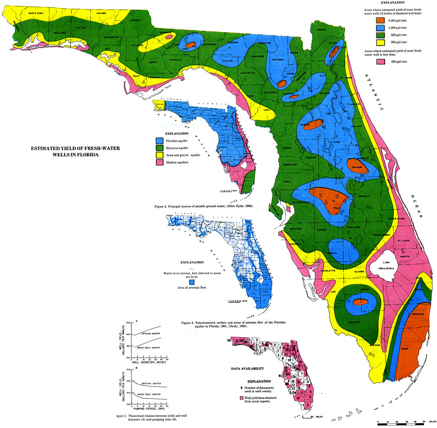
Description: This is a map of Florida showing the estimated yield of fresh-water wells, current to 1975. The following is taken from the article "Estimated Yield of Fresh-Water Wells in Florida" by Charles A. Pascale — "Well yield is an important aspect in designing ground-water supply systems and planning for water supply development." As shown in the key, the color codes represent the amount of gallons of fresh-water yield. Orange is 2,000 gal/min, blue is 1,000 gal/min, green is 500 gal/min, yellow is 250 gal/min and pink is less than 250 gal/min. Please see the article Estimated Yield of Fresh-Water Wells in Florida by Charles A. Pascale for more information.
Place Names: 1950-1999, Counties, Hillsborough, Atlantic Ocean, Gulf of Mexico, Lake Okeechobee, Orange, St. Johns River, Suwannee River
ISO Topic Categories: boundaries, inlandWaters, oceans, environment
Keywords: Estimated Yield of Fresh-Water Wells, hydrological, wells, physical, boundaries, inlandWaters, oceans, environment, Unknown,1975
Source: U. S. Geological Survey, Bureau of Geology, Florida Department of Natural Resources , Florida Water Atlas (Tallahassee, FL: Bureau of Geology, 1976)
Map Credit: Courtesy the University of South Florida Library |
|