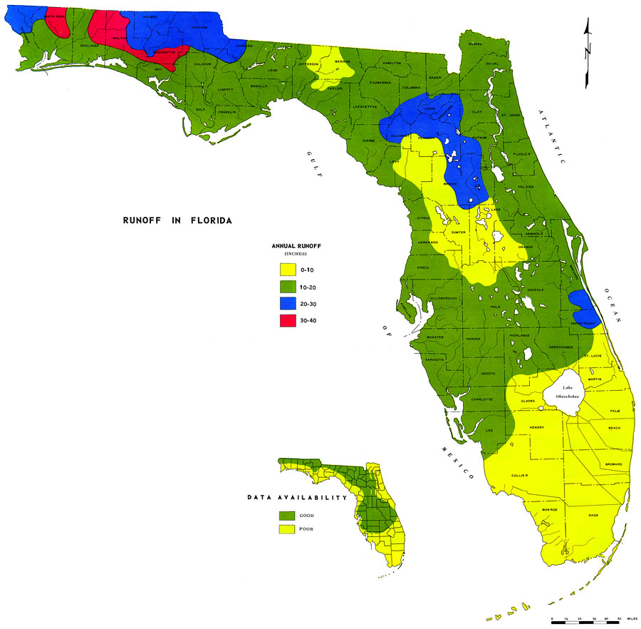
Description: This is a map showing the runoff in Florida, current to 1976. The following is taken from the article "Runoff in Florida" by W. E. Kenner — "Runoff is the water that is removed from an area by streams. Like rainfall, it is usually expressed in inches to indicate the depth to which the ground would have been covered had the water been retained on the land." The key shows annual runoff in inches. Light green is 0-10 in., dark green is 10-20 in., blue is 20-30 in. and pink is 30-40 in. Please see the article Runoff in Florida by W. E. Kenner for more information.
Source: U. S. Geological Survey, Bureau of Geology, Florida Department of Natural Resources , Florida Water Atlas (Tallahassee, FL: Bureau of Geology, 1976)
Map Credit: Courtesy the University of South Florida Library |
|