mapsExploring Florida
 FL Maps > State > 1950-1999 > Piezometric Surface of Florida, 1951
Site Map 

Piezometric Surface of Florida, 1951


Puzzle Directions: Click on a puzzle piece and drag it where you want it. When you connect two pieces correctly, they will join together. Mix up the pieces again. View finished map in pop-up window.

Title: Piezometric Surface of Florida
Projection: Unknown
Source Bounding Coordinates:
W: -88 E: -79 N: 31 S: 24

Back to Map Page
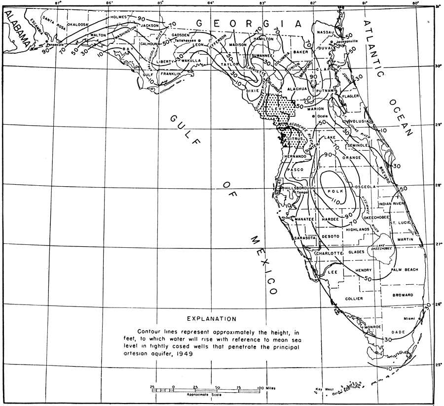
Description: This map from the Florida Geological Survey Bulletin number 33, shows the piezometric surface of Florida's artesian water system. The contour lines represent approximately the height, in feet, to which water will rise with reference to mean sea level in tightly cased wells that penetrate the principal artesian aquifer. Data gathered are from 1949.
Source: Robert O. Vernon, Geology of Citrus and Levy Counties, Florida (Tallahassee, FL: The Florida Geological Survey, 1951) 242
Map Credit: Courtesy the private collection of Roy Winkelman
SearchLicensePDF HelpGIS Help Google Earth Help Zoomify Help

 FL Maps > State > 1950-1999 > Piezometric Surface of Florida, 1951