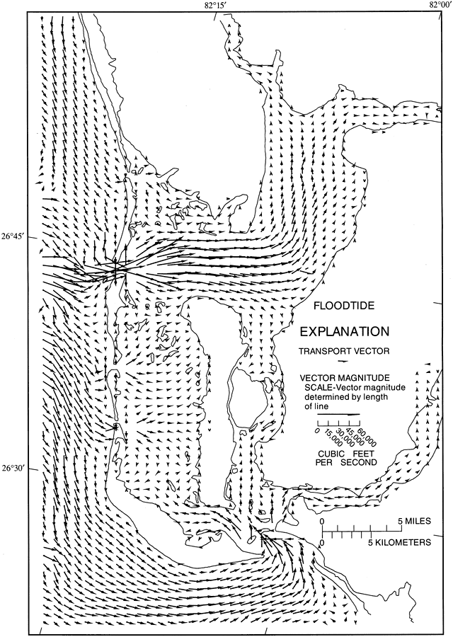
Description: This map from the U. S. Geological Survey Water Resources Investigation Report number 93-4153, Simulation of Tidal Flow, Circulation, and Flushing of the Charlotte Harbor Esturine System, shows typical water transport flow patterns during floodtide in Charlotte Harbor. The vector lengths are scaled to represent the volumetric rate of transport in cubic feet per second.
Place Names: 1950-1999, Charlotte Harbor, Gasparilla Sound, Pine Island Sound, San Carlos Sound, Caloosahatchee River, Sanibel Island, Captiva Island, Peace River, Punta Gorda, Matlacha Pass
ISO Topic Categories:
Keywords: Floodtide Water Transport Vectors in Charlotte Harbor, physical, hydrological, khydrology, physical features, currents, Unknown,1996
Source: Carl R. Goodwin, USGS Water Resources Investigations Report 93-4153 (Tallahassee, FL: U. S. Geological Survey, 1996) 77
Map Credit: Courtesy the University of South Florida Library |
|