mapsExploring Florida
 FL Maps > Region > 1950-1999 > Floodtide Water Transport Vectors in Charlotte Harbor, 1996
Site Map 

Floodtide Water Transport Vectors in Charlotte Harbor, 1996


Puzzle Directions: Click on a puzzle piece and drag it where you want it. When you connect two pieces correctly, they will join together. Mix up the pieces again. View finished map in pop-up window.

Title: Floodtide Water Transport Vectors in Charlotte Harbor
Projection: Unknown
Source Bounding Coordinates:
W: -82.5 E: -82 N: 27 S: 26.25

Back to Map Page
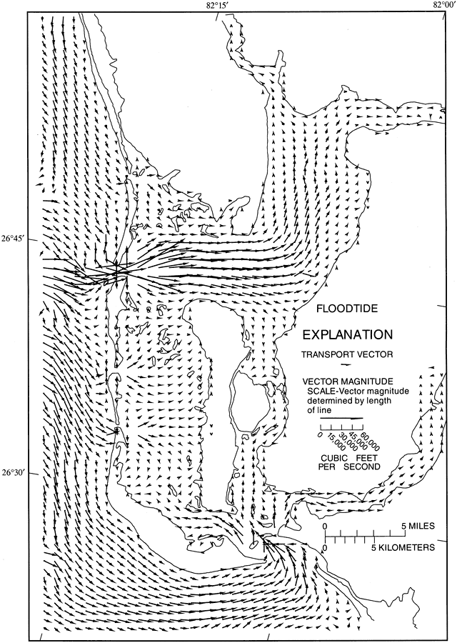
Description: This map from the U. S. Geological Survey Water Resources Investigation Report number 93-4153, Simulation of Tidal Flow, Circulation, and Flushing of the Charlotte Harbor Esturine System, shows typical water transport flow patterns during floodtide in Charlotte Harbor. The vector lengths are scaled to represent the volumetric rate of transport in cubic feet per second.
Source: Carl R. Goodwin, USGS Water Resources Investigations Report 93-4153 (Tallahassee, FL: U. S. Geological Survey, 1996) 77
Map Credit: Courtesy the University of South Florida Library
SearchLicensePDF HelpGIS Help Google Earth Help Zoomify Help

 FL Maps > Region > 1950-1999 > Floodtide Water Transport Vectors in Charlotte Harbor, 1996