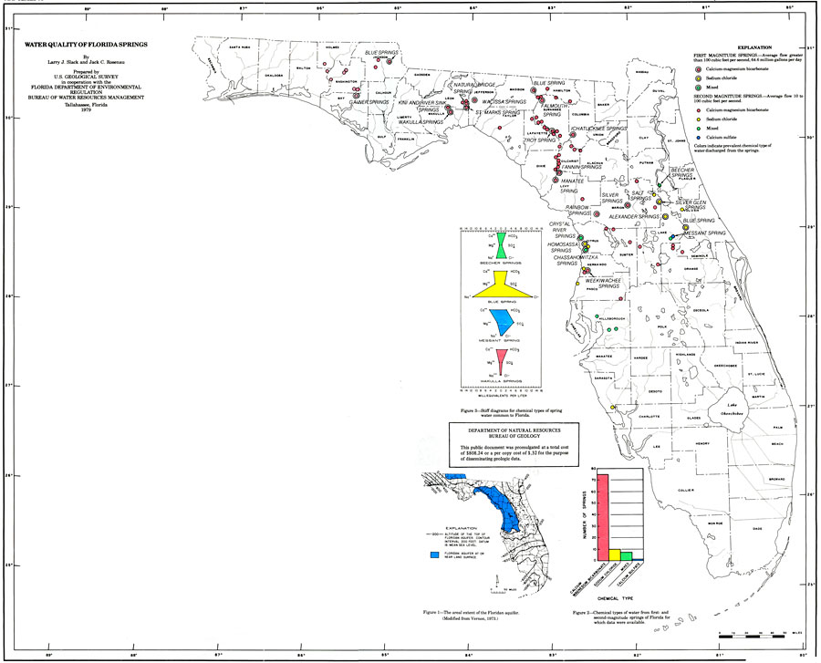
Description: This is a map showing water quality of Florida springs, current to 1979. First magnitude springs where the average flow is greater than 100 cubic feet per second are the ones with a larger circle with a little circle inside of it and they are pink, yellow and green. The second magnitude springs where the average flow is 10-100 cubic feet per second are the small circles that are pink, yellow, green and dark blue. Please see the article Water Quality of Florida Springs by Larry J. Slack and Jack C. Roseneau for more information.
Place Names: 1950-1999, Lake Okeechobee, Leon, Hillsborough, Dade, Escambia
ISO Topic Categories: boundaries, environment, geoscientificInformation, inlandWaters
Keywords: Water Quality of Florida Springs, physical, hydrological, political, geological, county borders, boundaries, environment, geoscientificInformation, inlandWaters, Unknown,1979
Source: U. S. Geological Survey, Bureau of Geology, Florida Department of Natural Resources, Florida Bureau of Geology (Tallahassee, FL: Florida Bureau of Geology, 1979)
Map Credit: Courtesy the University of South Florida Library |
|