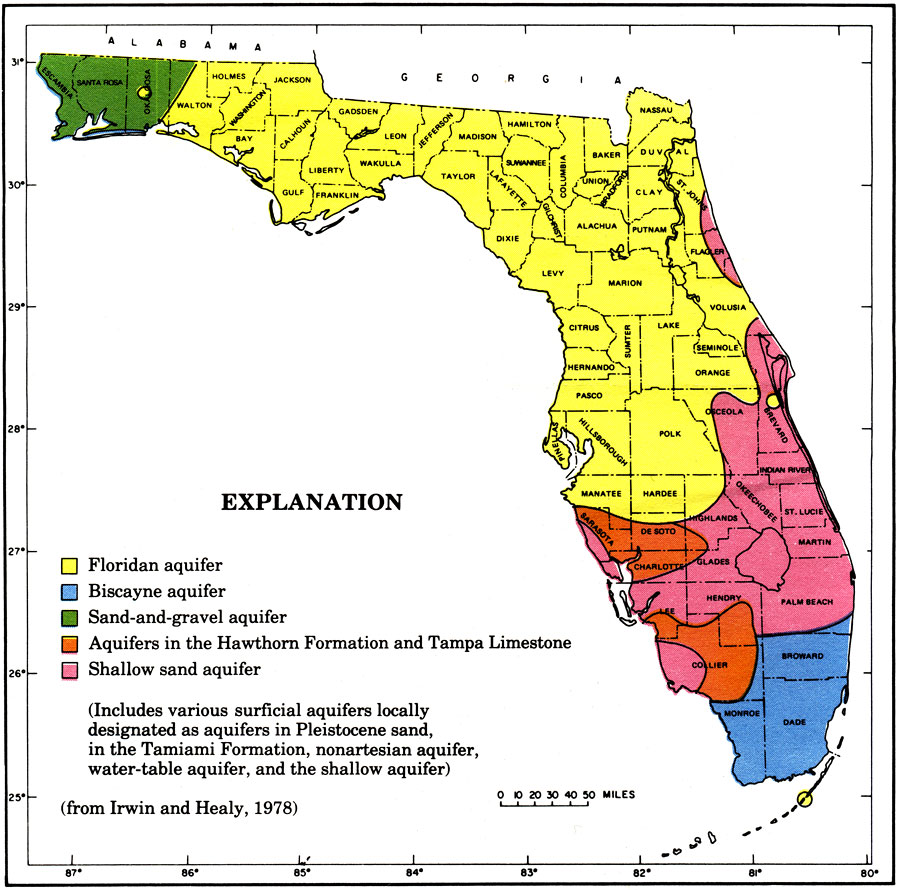
Description: This is a map showing the different aquifers in Florida, current to 1978. "It includes various surficial aquifers locally designated as aquifers in Pleistocene sand, in the Tamiami formation, nonartesian aquifer, water-table aquifer, and the shallow aquifer." — Irwin and Healy, 1978 The yellow is the Florida aquifer, blue is Biscayne aquifer, green is Sand-and-gravel aquifer, orange are aquifers in the Hawthorn Formation and Tampa Limestone and pink is shallow sand aquifer.
Source: U. S. Geological Survey, Bureau of Geology, Florida Department of Natural Resources, Florida Bureau of Geology (Tallahassee, FL: Florida Bureau of Geology, 1978)
Map Credit: Courtesy the University of South Florida Library |
|