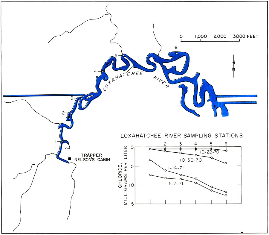
Description: This is a map showing the diminishing flow of the Loxahatchee River, current to 1973. "Diminishing flow of the Loxahatchee River brought about by land drainage and drought has caused ocean tides to reach farther up the river. Stations in the middle and upper reaches, shown above, are sampled regularly by the U. S. Geological Survey for salinity determinations." — Florida Bureau of Geology. Please see the article Encroaching Salt Water in Northeast Palm Beach County by Harry G. Rodis for more information.
Source: U. S. Geological Survey, Bureau of Geology, Florida Department of Natural Resources, Florida Bureau of Geology (Tallahassee, FL: Florida Bureau of Geology, 1973)
Map Credit: Courtesy the University of South Florida Library |
|