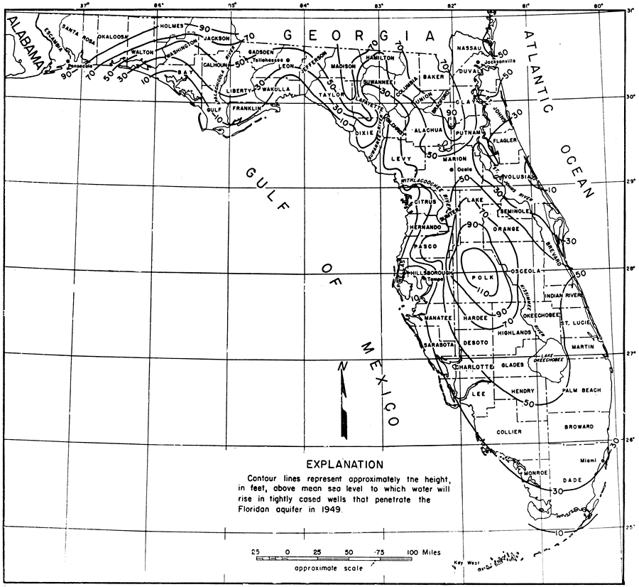
Description: This is a map showing the piezometric surface of the Floridian aquifer in Seminole County, current to 1949. "The piezometric surface of the Floridian aquifer in Florida is shown by the contour lines in figure 6. The contours on the piezometric surface indicate the direction of movement of the artesian water. Water enters the aquifer in the areas in which the piezometric surface is high and moves in a direction approximately perpendicular to the contour lines toward the areas in which the piezometric surface is low. One of the most favorable features of the piezometric surface in Florida is the dome centered in Polk County, which indicates that considerable recharge enters the Floridian aquifer in Polk County and some surrounding counties." — Jack T. Barraclough, U. S. Geological Survey, 1962
Place Names: 1920-1949, counties, Tampa, Miami, Gulf of Mexico, Atlantic Ocean, Key West, Jacksonville, Tallahassee, Ocala, St. Johns River, Kissimmee River, Suwannee River
ISO Topic Categories: boundaries, geoscientificInformation, inlandWaters, oceans
Keywords: Piezometric Surface of the Floridian Aquifer, physical, political, hydrological, aquifer, geological, county borders, boundaries, geoscientificInformation, inlandWaters, oceans, Unknown,1949
Source: Jack T. Barraclough, U. S. Geological Survey, Ground-Water Resources of Seminole County, Florida (Tallahassee, FL: Florida Geological Survey, 1962) 21
Map Credit: Courtesy the University of South Florida Library |
|