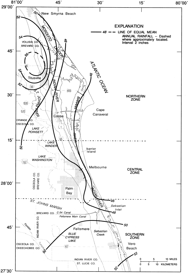
Description: This map from the U. S. Geological Survey Water Resources Investigation Report number 97-4011, Rainfall and Freshwater Discharge in the Indian River Basin, shows the average annual rainfall in the Indian River Basin from the period 1951 to 1980. The isolines show areas of equal mean annual rainfall in inches.
Place Names: 1950-1999, Titusville, Cape Canaveral, Melbourne, Sebastian Inlet, Vero Beach, Palm Bay, Lake Washington, Cocoa, Mosquito Lagoon, Banana River, Indian River, Brevard County, Indian River County,
ISO Topic Categories: boundaries, geoscientificInformation, inlandWaters, oceans
Keywords: Mean Annual Rainfall in the Indian River Basin, physical, political, meteorological, hydrological, khydrologicalphysical features, county borders, rainfall, drainage basins, boundaries, geoscientificInformation, inlandWaters, oceans, Unknown,1951 to 1980
Source: Lee Knowles, Jr. , USGS Water Resources Investigations Report 94-4193 (Tallahassee, FL: U. S. Geological Survey, 1995) 8
Map Credit: Courtesy the University of South Florida Library |
|