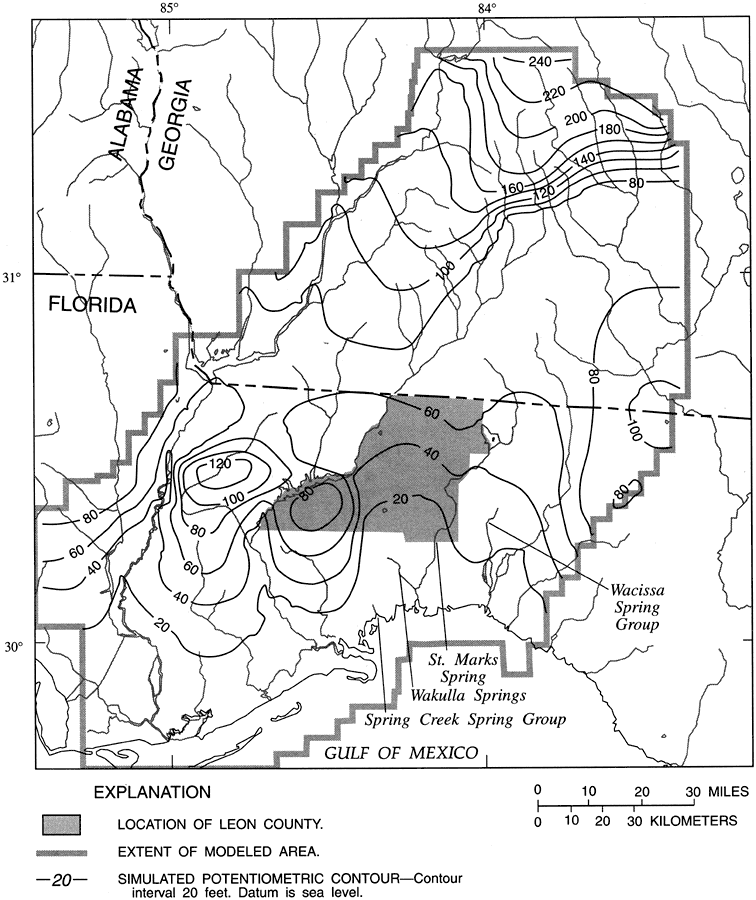
Description: This map from the U. S. Geological Survey Water Resources Investigation Report number 95-4296 shows the simulated potentiometric contours for the surface of the Upper Floridan aquifer in Leon County and adjacent study area.
Place Names: Leon, Tallahassee, Georgia, Gadsden County, Liberty County, Wakulla County, Franklin County, Jefferson County, Taylor County, Madison County, Calhoun County,
ISO Topic Categories: boundaries, geoscientificInformation, inlandWaters
Keywords: Simulated Potentiometric Surface of the Upper Floridan Aquifer in Leon County, physical, political, hydrological, khydrological, physical features, geological, major political subdivisions, county borders, drainage basins, water table, boundaries, geoscientificInformation, inlandWaters, Unknown,1996
Source: Hal Davis, USGS Water Resources Investigations Report 95-4296 (Tallahassee, FL: U. S. Geological Survey, 1996) 38
Map Credit: Courtesy the University of South Florida Library |
|