Puzzle Directions: Click on a puzzle piece and drag it where you want it. When you connect two pieces correctly, they will join together. Mix up the pieces again. View finished map in pop-up window. |
|
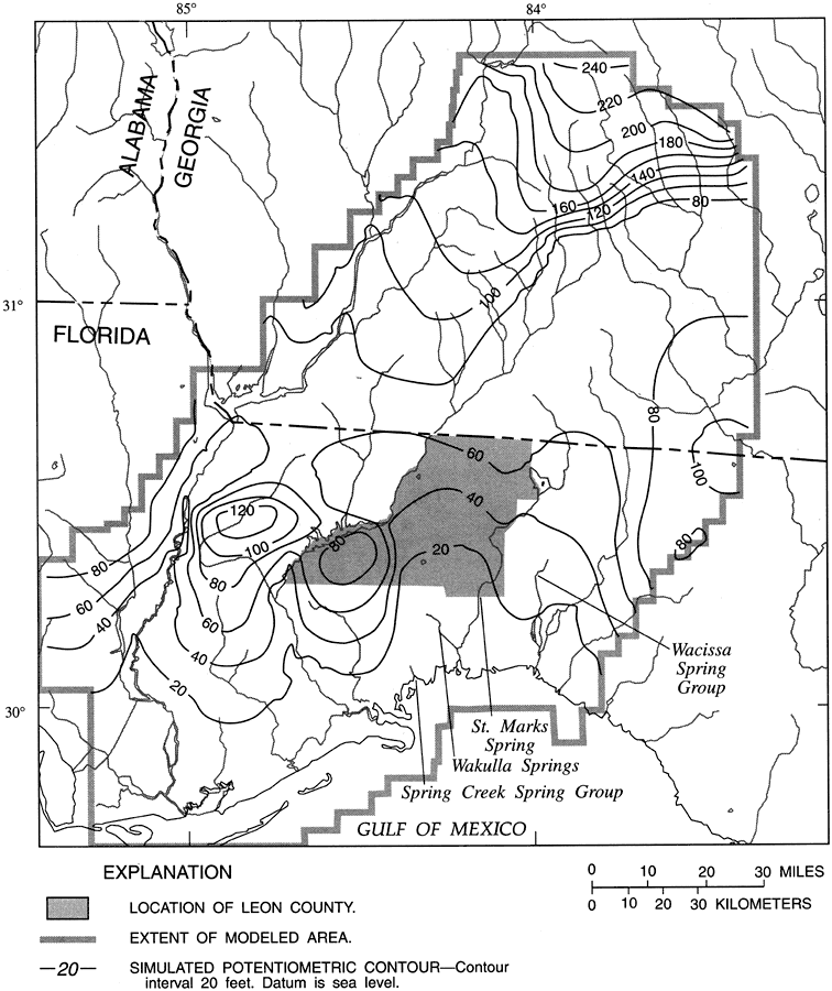
Title: Simulated Potentiometric Surface of the Upper Floridan Aquifer in Leon County
Projection: Unknown
Source Bounding Coordinates:
W: -85.3 E: -83 N: 32 S: 29.3 |
| | Description: This map from the U. S. Geological Survey Water Resources Investigation Report number 95-4296 shows the simulated potentiometric contours for the surface of the Upper Floridan aquifer in Leon County and adjacent study area.
Source: Hal Davis, USGS Water Resources Investigations Report 95-4296 (Tallahassee, FL: U. S. Geological Survey, 1996) 38
Map Credit: Courtesy the University of South Florida Library |
| |
| FL Maps > County > Leon > Simulated Potentiometric Surface of the Upper Floridan Aquifer in Leon County, 1996 | |
|