mapsExploring Florida
 FL Maps > Region > 2000- > Lower Reach of the Suwannee River , 2000
Site Map 

Lower Reach of the Suwannee River , 2000


Puzzle Directions: Click on a puzzle piece and drag it where you want it. When you connect two pieces correctly, they will join together. Mix up the pieces again. View finished map in pop-up window.

Title: Lower Reach of the Suwannee River
Projection: Unknown
Source Bounding Coordinates:
W: -83 E: -82.5 N: 29.5 S: 29

Back to Map Page
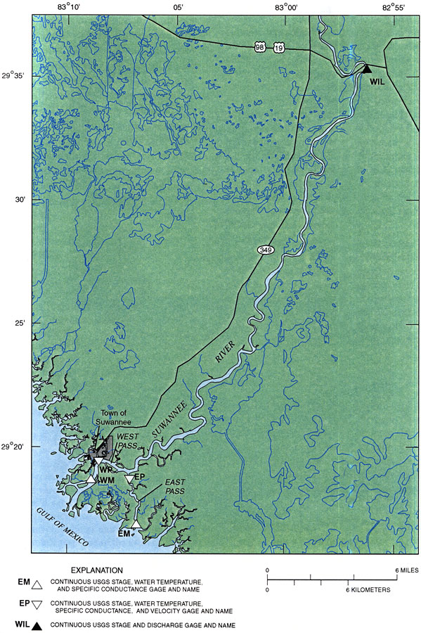
Description: This map from the U. S. Geological Survey Water Resources Investigation Report number 99-4268 shows the lower reach of the Suwannee River and Suwannee River Estuary. The map also shows the town of Suwannee, inland water systems, major roads, and the bird's-foot delta discharge of the Suwannee River into the Gulf of Mexico via the East Pass and West Pass.
Source: Gina M. Tillis, USGS Water Resources Investigations Report 99-4268 (Tallahassee, FL: U. S. Geological Survey, 2000) 4
Map Credit: Courtesy the University of South Florida Library
SearchLicensePDF HelpGIS Help Google Earth Help Zoomify Help

 FL Maps > Region > 2000- > Lower Reach of the Suwannee River , 2000