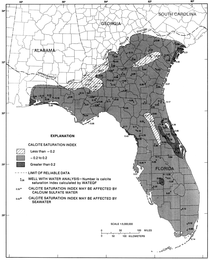
Description: This map from the U. S. Geological Survey Professional Paper 1403-1 shows the calcite saturation index computed from analyses of water samples from selected wells in the Upper Floridan aquifer, current to 1989. The diagonals show a saturation of less than -0.2 log units, the light shaded area shows a saturation of -0.2 to 0.2 log units and the dark shaded area shows a saturation of greater than 0.2 log units. Also shown are the wells with the saturation index next to it. Included in the analyses were field measurements of pH, temperature, and alkalinity as well as concentrations of major species. Also, the selected wells were located along major flow paths or major ground-water divides.
Source: Craig L. Sprinkle, USGS Professional Paper 1403-1 (Washington, : U. S. Government Printing Office, 1989) 132
Map Credit: Courtesy the University of South Florida Library |
|