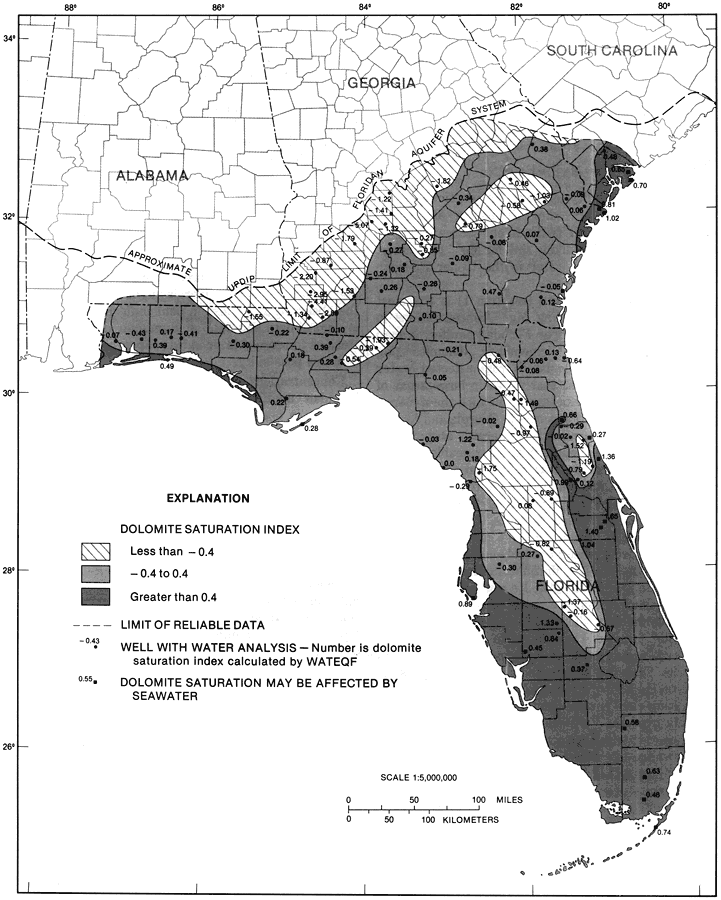
Description: This map from the U. S. Geological Survey Professional Paper 1403-1 shows the dolomite saturation index computed from analyses of water samples from selected wells in the Upper Floridan aquifer, current to 1989. The diagonals show a saturation of less than -0.4 log units, the light shaded area shows a saturation of -0.4 to 0.4 log units and the dark shaded area shows a saturation of greater than 0.4 log units. The map indicates that water in large areas of the Upper Floridan aquifer is near saturation with the mineral dolomite.
Source: Craig L. Sprinkle, USGS Professional Paper 1403-1 (Washington, : U. S. Government Printing Office, 1989) 138
Map Credit: Courtesy the University of South Florida Library |
|