mapsExploring Florida
 FL Maps > State > 1950-1999 > Chloride Concentrations from the Lower Floridan Aquifer Fig 24, 1989
Site Map 

Chloride Concentrations from the Lower Floridan Aquifer Fig 24, 1989


Puzzle Directions: Click on a puzzle piece and drag it where you want it. When you connect two pieces correctly, they will join together. Mix up the pieces again. View finished map in pop-up window.

Title: Chloride Concentrations from the Lower Floridan Aquifer Fig 24
Projection: Unknown
Source Bounding Coordinates:
W: -88 E: -80 N: 34 S: 25

Back to Map Page
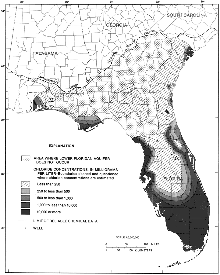
Description: This map from the U. S. Geological Survey Professional Paper 1403-1 shows the chloride concentrations in milligrams per liter in water from the Lower Floridan aquifer, current to 1989. The diagonals show less than 250 mg/l, the light shaded area shows 250 to less than 500 mg/l, the medium shaded area shows 500 to less than 1,000 mg/l, the medium-dark area shows 1,000 to less than 10,000 mg/l and the dark area shows 10,000 mg/l or more.
Source: Craig L. Sprinkle, USGS Professional Paper 1403-1 (Washington, : U. S. Government Printing Office, 1989) 152
Map Credit: Courtesy the University of South Florida Library
SearchLicensePDF HelpGIS Help Google Earth Help Zoomify Help

 FL Maps > State > 1950-1999 > Chloride Concentrations from the Lower Floridan Aquifer Fig 24, 1989