mapsExploring Florida
 FL Maps > State > 1950-1999 > Concentrations of Dissolved Silica from the Upper Floridan Aquifer Fig 30, 1989
Site Map 

Concentrations of Dissolved Silica from the Upper Floridan Aquifer Fig 30, 1989


Puzzle Directions: Click on a puzzle piece and drag it where you want it. When you connect two pieces correctly, they will join together. Mix up the pieces again. View finished map in pop-up window.

Title: Concentrations of Dissolved Silica from the Upper Floridan Aquifer Fig 30
Projection: Unknown
Source Bounding Coordinates:
W: -88 E: -80 N: 34 S: 25

Back to Map Page
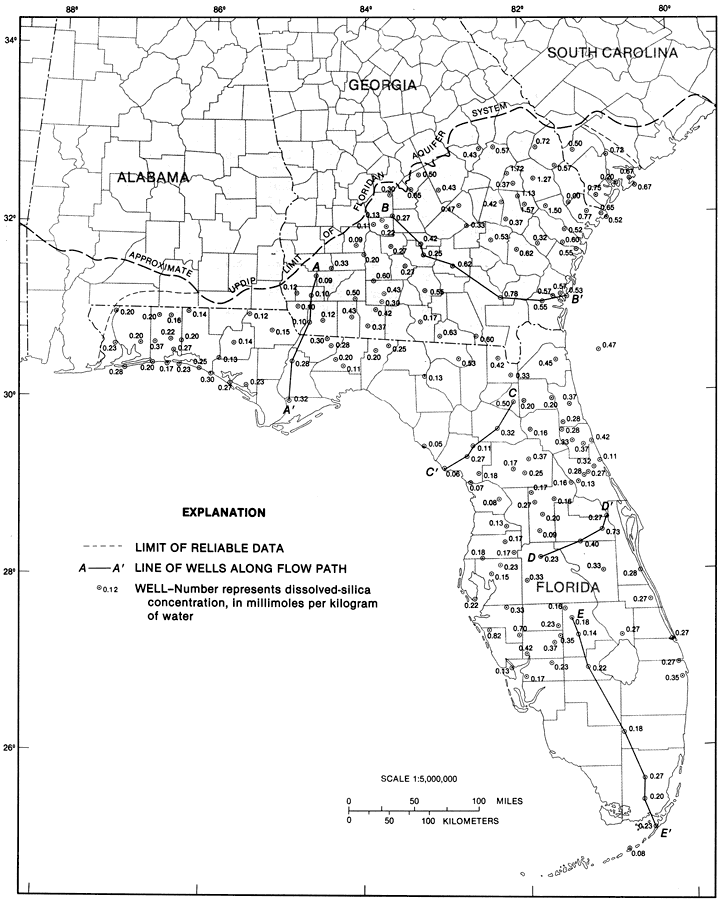
Description: This map from the U. S. Geological Survey Professional Paper 1403-1 shows the concentrations of dissolved silica in water samples from selected wells in the Upper Floridan aquifer, current to 1989. The A-A' is the line of wells along the flow path. The dots are wells and the number represents dissolved silica concentration in millimoles per kilogram of water.
Source: Craig L. Sprinkle, USGS Professional Paper 1403-1 (Washington, : U. S. Government Printing Office, 1989) 164
Map Credit: Courtesy the University of South Florida Library
SearchLicensePDF HelpGIS Help Google Earth Help Zoomify Help

 FL Maps > State > 1950-1999 > Concentrations of Dissolved Silica from the Upper Floridan Aquifer Fig 30, 1989