mapsExploring Florida
 FL Maps > State > 1950-1999 > Concentrations of Aluminum from the Upper Floridan Aquifer Fig 32, 1989
Site Map 

Concentrations of Aluminum from the Upper Floridan Aquifer Fig 32, 1989


Puzzle Directions: Click on a puzzle piece and drag it where you want it. When you connect two pieces correctly, they will join together. Mix up the pieces again. View finished map in pop-up window.

Title: Concentrations of Aluminum from the Upper Floridan Aquifer Fig 32
Projection: Unknown
Source Bounding Coordinates:
W: -88 E: -80 N: 34 S: 25

Back to Map Page
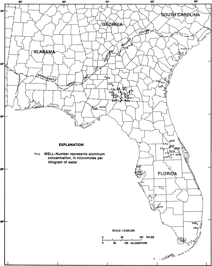
Description: This map from the U. S. Geological Survey Professional Paper 1403-1 shows the concentrations of aluminum in water samples from selected wells in the Upper Floridan aquifer, current to 1989. The dots are wells and the number represents aluminum concentration in micromoles per kilogram of water. There are 44 samples shown and they were chosen to give maximum areal coverage.
Source: Craig L. Sprinkle, USGS Professional Paper 1403-1 (Washington, : U. S. Government Printing Office, 1989) 166
Map Credit: Courtesy the University of South Florida Library
SearchLicensePDF HelpGIS Help Google Earth Help Zoomify Help

 FL Maps > State > 1950-1999 > Concentrations of Aluminum from the Upper Floridan Aquifer Fig 32, 1989