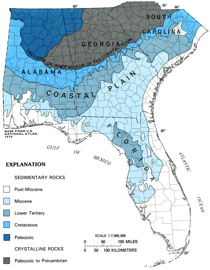
Description: This map from the U. S. Geological Survey Professional Paper 1403-C shows generalized geologic features of the southeastern United States, including the area of the Floridan aquifer system. The map shows the physiologic features of the coastal plain and the fall line or inner margin of the coastal plain. The map shows sedimentary rocks ranging in age from Paleozoic to Post-Miocene, and crystalline rock from Paleozoic to Precambrian. In Florida there are no crystalline rocks, and sedimentary rocks range from Post-Miocene to Lower Tertiary.
Place Names: 1950-1999, counties
ISO Topic Categories: boundaries, geoscientificInformation, inlandWaters, oceans
Keywords: Generalized Geologic Map of the Southeastern United States, physical, political, hydrological, khydrological, kFloridan aquifer, kphysiologic, physical features, geological, major political subdivisions, county borders, water table, boundaries, geoscientificInformation, inlandWaters, oceans, Unknown,1988
Source: P. W. Bush and R. H. Johnston, USGS Professional Paper 1403-C (Washington, DC: U. S. Government Printing Office, 1988) C4
Map Credit: Courtesy the University of South Florida Library |
|