mapsExploring Florida
 FL Maps > State > 1950-1999 > Decline of Potentiometric Surface of the Floridan Aquifer, 1988
Site Map 

Decline of Potentiometric Surface of the Floridan Aquifer, 1988


Puzzle Directions: Click on a puzzle piece and drag it where you want it. When you connect two pieces correctly, they will join together. Mix up the pieces again. View finished map in pop-up window.

Title: Decline of Potentiometric Surface of the Floridan Aquifer
Projection: Unknown
Source Bounding Coordinates:
W: -88 E: -79 N: 35 S: 24

Back to Map Page
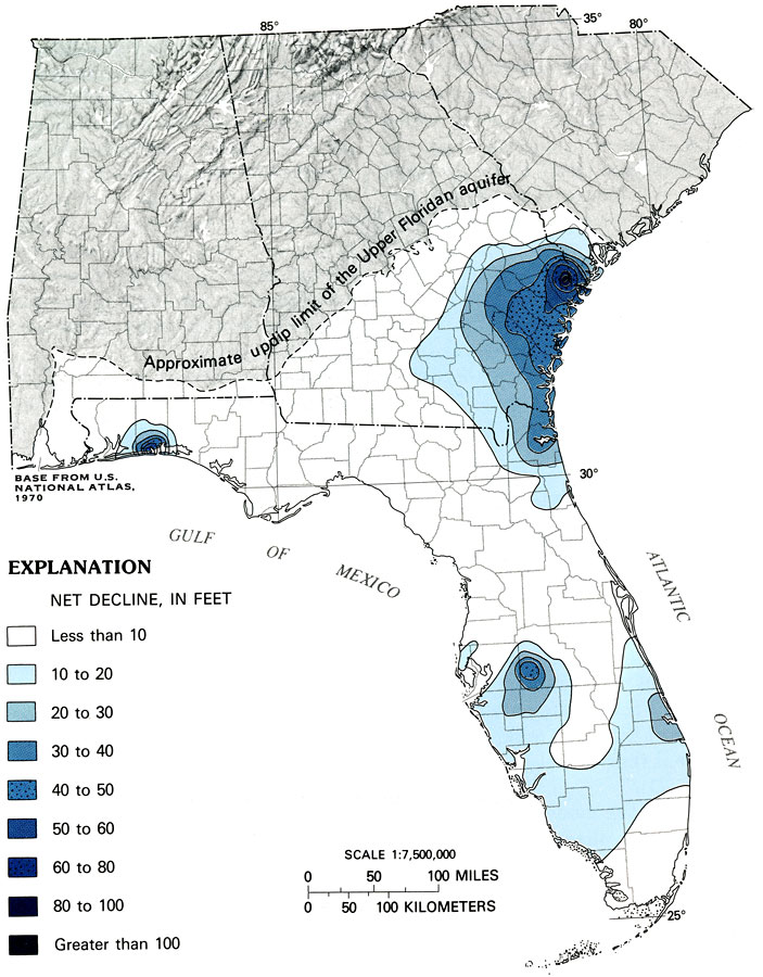
Description: This map from the U. S. Geological Survey Professional Paper 1403-C shows the net decline, in feet, between simulated predevelopment potentiometric surface and simulated May 1980 potentiometric surface of the Upper Floridan aquifer.
Source: P. W. Bush and R. H. Johnston, USGS Professional Paper 1403-C (Washington, DC: U. S. Government Printing Office, 1988) C32
Map Credit: Courtesy the University of South Florida Library
SearchLicensePDF HelpGIS Help Google Earth Help Zoomify Help

 FL Maps > State > 1950-1999 > Decline of Potentiometric Surface of the Floridan Aquifer, 1988