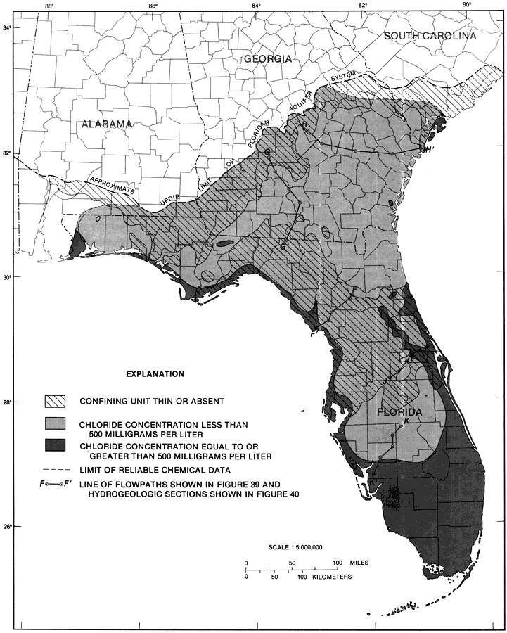
Description: This map from the U. S. Geological Survey Professional Paper 1403-1 shows the relation of chloride concentrations in milligrams to confined-unconfined conditions of the Upper Floridan aquifer, current to 1989. The diagonal area shows where the confining unit is thin or absent. The light shaded area shows chloride concentration less than 500 milligrams per liter. The dark shaded area shows chloride concentration equal to or greater than 500 milligrams per liter. The F-F' is the line of flowpaths from figure 39 and the hydrogeologic sections from figure 40.
Place Names: 1950-1999, counties
ISO Topic Categories: boundaries, geoscientificInformation
Keywords: Relation of Chloride Concentrations to Confined-Unconfined Conditions Fig 38, physical, hydrological, kFloridan aquifer, khydrological, political, geological, county borders, boundaries, geoscientificInformation, Unknown,1989
Source: Craig L. Sprinkle, USGS Professional Paper 1403-1 (Washington, : U. S. Government Printing Office, 1989) 187
Map Credit: Courtesy the University of South Florida Library |
|