mapsExploring Florida
 FL Maps > Local > Leon > Detail from an Aero-View of Tallahassee, 1926
Site Map 

Detail from an Aero-View of Tallahassee, 1926


Puzzle Directions: Click on a puzzle piece and drag it where you want it. When you connect two pieces correctly, they will join together. Mix up the pieces again. View finished map in pop-up window.

Title: Detail from an Aero-View of Tallahassee
Projection: Unknown
Source Bounding Coordinates:
W: E: N: S:

Back to Map Page
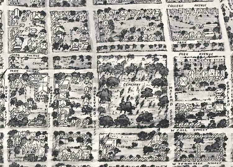
Description: A detail from an aero-view of the City of Tallahassee, the State Capital of Florida in 1926. This map orientation is from north to south, looking toward the Gulf of Mexico. From this point of view, south is toward the top of the map. View includes the area bounded by College Avenue, Duval Street, West Tennessee Street, and Copeland Street. Also includes Leon High School and the cemetery. Perspective map not drawn to scale.
Source: James Wynne, LC Panoramic maps (2nd ed.), 119 (, : n.p., 1926) 119
Map Credit: Courtesy of the Library of Congress
SearchLicensePDF HelpGIS Help Google Earth Help Zoomify Help

 FL Maps > Local > Leon > Detail from an Aero-View of Tallahassee, 1926