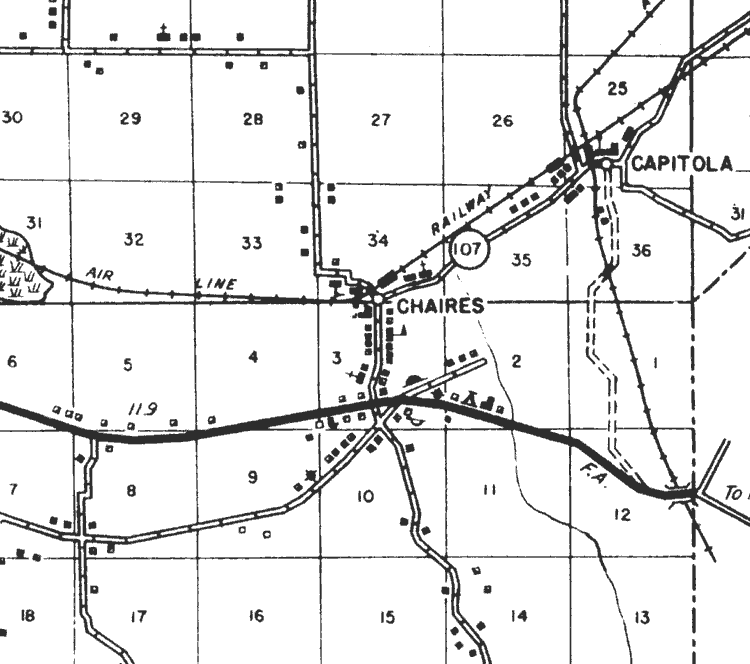
Description: This is a detail of a map of the transportation system in Leon County, Florida that specifies Chaires. Section Township Range (STR) is shown. This map shows divided highways, dwellings, schools, churches, small businesses, and a saw mill. Key to Florida Highway maps.
Place Names: Leon, Chaires, Capitola,
ISO Topic Categories: boundaries, transportation, inlandWaters
Keywords: Detail - Highway and Transportation Map of Leon County, physical, political, transportation, physical features, local jurisdictions, roads, boundaries, transportation, inlandWaters, Unknown,1940
Source: , Florida State Road Department (Tallahassee, FL: FDOT, 1940)
Map Credit: Courtesy of the Pennsylvania State University Libraries Map Library |
|