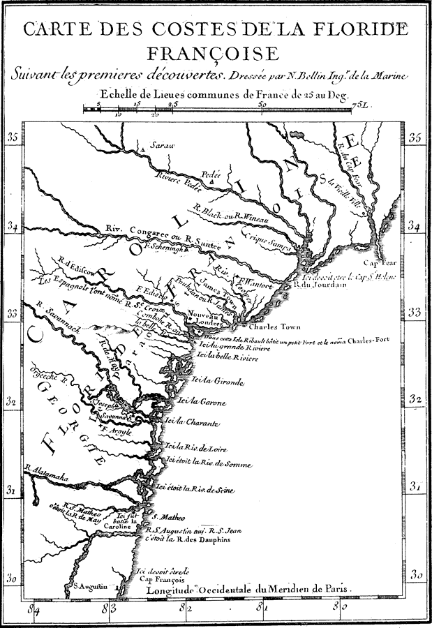
Description: Map shows the French governed colonies in Florida and easther U.S. during 1562 C.E. and through 1565 C.E. Shows all major rivers during this period in history.
Place Names: Before 1700, Saint Augustine
ISO Topic Categories: oceans, �inlandWaters
Keywords: Map of French Florida Colony, physical, �historical, physical features, oceans, �inlandWaters, 1562
Source: Woodbury Lowery, The Spanish Settlements within the Present Limits of the United States: Florida (New York , NY: G. P. Putnam's Son , 1911) 34
Map Credit: Courtesy the private collection of Roy Winkelman |
|